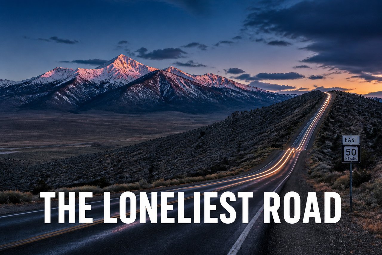
Sacramento Pass: Top of the World on the Loneliest Road
There is a sign on Highway 50 east of Ely that warns you about services: next services 100 miles, or some such number. But between Ely and the little town of Baker, the highway does something wonderful first - it climbs. Out of the Ely valley, up the flank of the Schell Creek Range, and over a summit the map calls Sacramento Pass. Just over 7,000 feet, give or take, and the top of the world as far as this stretch of sagebrush is concerned.
We have crossed this pass a few times now, and it never gets old. Coming from the east, you round the shoulder of the range and the whole Spring Valley opens up in front of you, wide and flat and miles across, with the Snake Range standing off to the south and Wheeler Peak - all 13,063 feet of it - catching the light. It is the kind of view that makes you pull over, and the good people at the Bureau of Land Management know it: there is a recreation area right at the pass with camping, shade structures, and those long desert sightlines. We have spent the night there with a grand total of two other rigs in view, and a night sky you would not believe.
The Loneliest Road in America
Highway 50 across central Nevada earned its famous nickname in 1986, when Life magazine ran a piece quoting an automobile association spokesman who warned travelers not to drive it unless they were confident of their survival skills. Nevada, bless its heart, turned the insult into a badge: the state now issues a Highway 50 Survival Guide, stamped at towns along the way, certifying you crossed the Loneliest Road. The Chamber of Commerce humor is great, but the honest truth is better. This is not an empty landscape. It is a quiet one.
Drive it slowly and the road gives you everything: basin after range after basin, the classic Great Basin rhythm of flat valley and upthrust mountain, over and over, like waves of stone that never broke. The pass country between Ely and Baker is one of the prettiest stretches, because the road finally stops being flat. It climbs through pinyon and juniper, the sage turns to mountain brush, and in spring there are wildflowers in the draws and cattle on the flats. In March we have seen black ice in the shadowed curves - this is high country, whatever the desert around it looks like.
Gateways and Crossings
For travelers, Sacramento Pass is the doorway to Great Basin National Park. The turnoff drops south off Highway 50 a few miles east of the summit, running down into Snake Valley toward Baker, Nevada - population well into the low hundreds, which tells you something about the neighborhood - and from there, the road into the park climbs toward Wheeler Peak. Coming off the pass with the peak dead ahead, it is impossible to miss. We planned the pass crossing and the park visit as one stop, and you should too.
But the pass has older stories than highway nostalgia. Early travelers crossing between the valleys used both this pass and its neighbor, Connors Pass, west of Ely, threading wagons through the Schell Creek Range on the way to springs and meadows further along. The range itself got its name from soldiers who camped under the ridge and shot their supper out of the air - the whole crest once echoed with the cacophony of Band-tailed pigeons, or so the story goes. Ranchers have worked the valley floors here for a century and a half; you will see their cattle guards and irrigation pivots long before you see a traffic light.
Camping at the Pass
The BLM Sacramento Pass Recreation Area deserves a shout-out for the RV crowd. It sits right at the summit, with level gravel pads, picnic shelters, vault facilities, and - the real luxury - a view in three directions. We ran the solar hard all morning and read the History of the pass country all afternoon. Nights up here are cool even when the valleys bake; we have watched the thermometer fall twenty degrees between dinner and dark. Bring a jacket in every month but July, and bring it in July too.
And the stars. This stretch of Nevada is so far from city light that the Milky Way does not just show up - it dominates. We lay in the truck bed one night at the pass and counted a dozen shooting stars before giving up on counting. If you have ever wanted to explain to your grandchildren what a night sky used to look like, this is the place to book the lesson.
Why We Stopped Twice
On the way east, Sacramento Pass is a speed bump with a view - twenty minutes of oohing and ahhing, a photo of Wheeler Peak, and gone. On the way home, we camped there two nights and let the desert set the pace. Both visits were right. But the second one is the one we talk about.
The Loneliest Road is only lonely if you drive it like a sentence you are trying to finish. Slow down at the passes. They are the punctuation marks of the Great Basin - the pauses where the whole story makes sense.